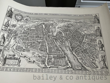
A Large Reproduction Claes Visscher 1618 Map of Paris - MapVisscher
scroll down for more images, description and sizes
Product Description & More Photos
to view postage costs simply ADD TO CART
* purchase not required *
A large Claes Visscher 1618 Map of Paris. Claes Janszoon Visscher II reproduction map of the city of Paris, Lutetia Parisorum urbs, toto orbe celeberrima notissimaque, caput regni Franciae, 1618. This is printed on heavy paper or card. This was found as part of an estate with other prints and paintings in Paris - (the owner may have had a print and art shop as some of the maps seem to be the same size). Please note we are not experts in this field by any means and unfortunately do not know any further details. The map will be rolled and shipped in a mailing tube.
SIZE approx: 104cm wide x 73cm high - Printed area: 85cm wide x 54.5cm high


DISCLAIMER: while we make every effort to show true colours, artificial and natural lighting during photographing and your viewing device, over which we have no control, may affect the final result
 Loading... Please wait...
 phone: 0414 830 197

 subscribe and be notified of new french arrivals


